Breakwater, Mole, or Seawall: Three Edges Built for Different Jobs
Breakwater, mole, or seawall: learn how position, shoreline connections, and harbor surroundings help you describe each structure without guessing its name.
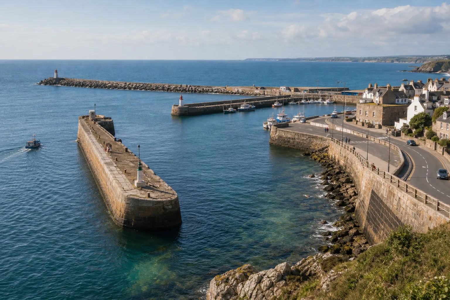
On a harbor walk, you might see a stone arm reach from shore, a low barrier sitting offshore, and a wall following the road at the water’s edge. To distinguish a breakwater, mole, or seawall, note where each stands and what space or land it borders.
Local names can vary, and one structure may serve more than one purpose. Position and visible use offer a careful starting point; a harbor plan or local sign can help confirm the formal name.
Distinct harbor roles
A breakwater is a barrier intended to reduce wave action in a harbor, anchorage, or nearby stretch of coast. It is often placed offshore or across part of an opening, though it may connect to land at one end. Its role is to provide shelter, not necessarily to form a dry boundary along a road or building.
A mole is a substantial structure projecting from shore into the water, often forming or protecting part of a harbor entrance or basin. It may also provide a working surface, walkway, or sheltered side for vessels. The term can overlap with breakwater when the projecting structure also helps shelter water.
A seawall runs along the shoreline and is intended to protect land behind it from wave action, erosion, or flooding. A road, promenade, open ground, or buildings may sit directly landward. A wall beside a harbor is not automatically a seawall; it could instead be a quay or retaining wall serving waterfront work.
These distinctions describe common functions, not universal naming rules. A harbor authority may use a local name for a structure with several roles, while a coastal plan may group different shoreline defenses under broader terms.
Position and setting
Read a structure in relation to the whole harbor. A barrier separated from shore, or joined to land only at one end, may be doing breakwater work. A long arm projecting from shore and shaping a basin may be called a mole; a wall tracking the coast beside land may be a seawall.
Ask what the structure borders. If it faces moored vessels and an inner basin, describe its harbor-sheltering role. If a road, promenade, or open area lies directly behind it, note that it also occupies a shoreline-protection position. A structure can serve both settings, so record both when the scene supports it.
Paths and lights are useful clues, not decisive labels. A mole may carry a path or harbor equipment, but a seawall may have a promenade and a breakwater may be accessible too. Give more weight to the structure’s connection to shore and its place in the harbor layout.
Shapes and materials
Breakwaters may have sloping faces, stepped profiles, or exposed stone and concrete units. Some have broad tops; others sit low or partly below the surface. No single shape identifies every breakwater.
Moles often appear as substantial arms with a route or working surface on top. They can narrow an entrance, divide water areas, or create a sheltered side. A mole that also reduces wave exposure has an overlapping role.
Seawalls commonly follow the coast. Their water-facing side may be vertical, curved, stepped, or sloped, while the landward side meets a road, park, or building line. Stone, masonry, and concrete can appear in all three kinds of structure, so material alone is a weak guide.
Reading water and access
A breakwater can shelter water behind it, but waves may still enter through an opening or around an end. The conditions inside a harbor reflect the full layout, including its entrance, neighboring coast, and other barriers.
A mole projects into water and may shape the space around an entrance or basin. Its end can border a navigation route or shelter vessels alongside, depending on its placement. The visible layout can suggest a role, but it does not by itself establish how currents behave.
A seawall stands along the shore rather than offshore across a harbor opening. Its presence alone does not tell you how waves behave nearby or how well the land is protected; those questions depend on the site and the structure’s design. Avoid claiming that a seawall redirects or reduces wave energy in a particular way unless a qualified source or site documentation supports it.
From a safe public viewpoint, note whether water lies on both sides, whether land runs directly behind the structure, and whether a channel remains beside an end. A harbor plan can clarify connections that are hidden from view. Do not climb onto harbor structures: wet surfaces, algae, wakes, and changing water levels can make access hazardous.
Field observation checklist
Use these observations from a public path or another safe viewing place. Each item leads to a cautious description or a next source to consult; when clues conflict, describe the visible layout rather than forcing a label.
- Check whether water lies on both sides. If the barrier stands apart from shore, consider describing it as an offshore barrier or possible breakwater; if it follows the coast, compare it with a seawall. If the connection is hidden, say it is unclear and consult a harbor plan.
- Check whether the structure projects from land into the harbor. If it forms a substantial arm, consider the term mole; if it does not, describe its actual position instead. If the land connection is obscured, avoid assigning a firm name and check a map or plan.
- Check what lies behind the structure. If a basin or moored vessels are on the sheltered side, note its harbor role; if a road, park, or buildings sit directly landward, note its shoreline setting. If both are present, record both rather than choosing only one.
- Check for an entrance gap or channel beside an end. If one is visible, describe how the barrier borders access to the basin; if none is visible, do not assume the harbor is closed. If the route is obscured, consult a chart or port information before describing it.
- Check whether vessels berth along a sheltered side. If they do, note the structure’s relation to harbor use; if they do not, do not rule out a mole, since berthing is not required. If no vessels are present, describe only the visible layout.
- Check whether a wall follows the shoreline beside land. If it does, consider a seawall or another shoreline structure; if it sits apart from shore, consider a breakwater role. If the coast is hard to trace, record the uncertainty and compare the scene with a harbor plan.
- Check for a local name on a sign or harbor plan. If one is given, use it and add a plain-language description of position and purpose; if none is available, use a cautious functional description. If the local name differs from your visual impression, retain the local term and describe what you can see.
Questions about harbor barriers?
Can a mole also be a breakwater?
Yes. A projecting mole may also help shelter harbor water, so the terms can describe different aspects of one structure. Use the local name when available, then describe its position and visible role.
Is every wall beside the sea a seawall?
No. A quay or retaining wall may support waterfront work without being chiefly a shoreline defense. Check its relationship to the coast and the land behind it before choosing a label.
Can a breakwater connect to land?
Yes. A breakwater may meet the coast at one end, or a harbor arm may combine shore access with a sheltering role. Its place in the full layout matters more than whether it touches land.
What if the structure’s purpose is unclear?
Describe visible facts first, such as “an offshore stone barrier beside the inner basin.” A harbor plan, local sign, or port authority description may clarify the formal name without changing the visible description.
A worked harbor reading
Imagine you are standing on a public path. In this invented situation, the starting observations are one stone arm joined to a headland, one path and one light on top, an inner basin beside the arm, and a separate low ridge offshore with one visible gap nearby. These are scene details for the example, not measured findings.
First, record the arm’s connection to land and its position beside the basin. Because it projects into the harbor, describe it as a likely mole; because the basin lies beside it, note its possible sheltering role without claiming a specific wave effect. Next, record the ridge as separate from shore and note the gap. Describe it as a possible breakwater, while leaving the channel’s navigational status unconfirmed until a chart or port source verifies it.
The field note can read: “One projecting harbor arm, likely a mole, borders the inner basin; a separate offshore ridge may be a breakwater, with a visible gap whose navigation status is unconfirmed.” If a local sign names either structure, use that name and keep the positional description. The result is a clear account of what is visible, with formal identity and channel use left open where the scene cannot settle them.
Useful harbor descriptions
For a breakwater, mole, or seawall, begin with three observations: whether it lies offshore or along the coast, whether it projects into the harbor, and what lies beside or behind it. Then note paths, berthing, openings, and local names. This order helps separate a harbor-sheltering role from a shoreline setting without pretending that every structure has only one job.
A useful field note pairs a cautious label with plain language: “shoreline wall beside the road” or “projecting harbor arm beside the inner basin.” When you search for breakwater mole or seawall, the most reliable descriptions keep the visible layout distinct from claims about formal names or wave behavior.
More harbor reading

What Happens Between a Ship’s Arrival and Its Departure
A ship’s time in port follows a practical sequence, from berth assignment and cargo work to…
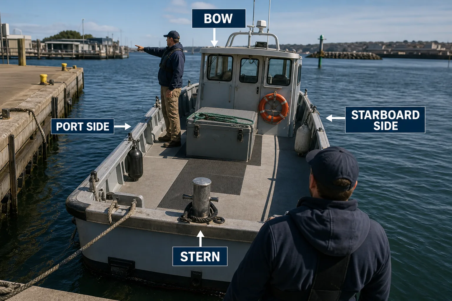
Bow, Stern, Port, and Starboard: A Clear Map of a Vessel
Learn bow, stern, port, and starboard from a vessel’s own orientation, so dockside directions stay clear…