Planning a Quay for Port Work and Public Access
Quay planning maps port work and public access in one clear layout, helping teams spot route conflicts, mark boundaries, and direct visitors safely.
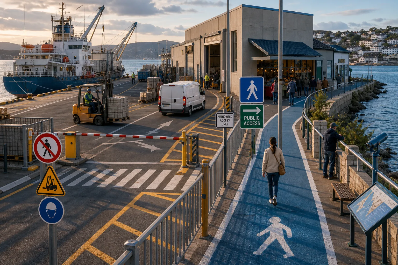
A forklift turns toward a warehouse door as a visitor approaches the same harbor entrance from the sidewalk. Quay planning starts with this ordinary overlap: tracing where vessels, workers, deliveries, and visitors need to go, then making their routes and limits legible.
The question is not simply whether a quay should be working or public. It is which activities belong there, where they happen, and how people can recognize what is open. A planning checklist can help surface conflicts, but it is not a site-specific safety or regulatory review.
Define the operation
Begin by naming the work the quay must support. A cargo berth connects a vessel with handling space, storage, and onward transport; a passenger landing needs approaches and exits; a service area needs access for crews, supplies, and maintenance.
Trace each movement from its starting point to its destination. Include pedestrians, vehicles, goods, and access to nearby buildings. Mark every place routes meet, and identify who is responsible for managing each crossing during active work.
Separate competing routes
A plan can make different activities easier to read without suggesting that conflicts never occur. Show pedestrian paths, vehicle entrances, berth connections, gates, and barriers together. Signs and pavement markings should match the physical layout and any access controls.
For a public waterfront, show a continuous route to public destinations and places to pause outside restricted work areas. Keep loading doors and equipment paths clear. Where a sign alone would not communicate a necessary restriction, show an appropriate physical control for review rather than relying on wording alone.
These are planning considerations, not instructions to install a particular control. The harbor operator and qualified design professionals should assess proposed routes and controls against site conditions, applicable rules, and the responsibilities of the people who operate and maintain the quay.
Check the site plan
Use this list to identify questions for the design team, not to approve a layout. For each observation, follow the stated decision and take the alternative action if the condition is not met.
- Pedestrian route: Check whether the sidewalk connects to the intended public destination without passing through active work. If it does, show its route and entry; if it does not, redirect the route or propose restricted access for site-specific review.
- Vehicle access: Check whether delivery and service vehicles have a defined approach to their work area. If the route is clear, show its control point; if it overlaps a public path, revise the entrance or specify a crossing-management plan for operator and professional review.
- Loading doors: Check whether a public route or gathering place sits beside an active loading door. If it does not, preserve the separation; if it does, consider moving the route or propose a reviewed access control for loading periods.
- Berth connection: Check whether the route from vessel to handling area or service building is unobstructed. If it is, preserve the operating space; if it is not, relocate the competing use or have the operator assess another arrangement.
- Boundary signs and barriers: Check whether a visitor can identify where public access ends. If signs and physical controls agree, keep them consistent; if they do not, revise the boundary or route so the limit is clearer.
- Changing access: Check whether a gate or route changes with operating conditions or season. If access remains open, show the continuous public path; if it changes, identify who controls the transition and show an alternative route.
Connect quay and street
The landward edge can become a pinch point when a building entrance, loading door, vehicle approach, and waterside path share the same frontage. Trace each route separately, mark the crossings, and identify who controls them. If a crossing cannot be removed, submit its proposed management for review by the responsible operator and design professionals.
Say a small harbor plan begins with one street entrance, a fish market loading door, a public viewing area, and a market entrance. Draw the service van’s route from the street to the loading side, then draw visitors’ routes from the sidewalk to the market entrance and viewing area. If those lines overlap at the entrance, revise the plan to show a distinct pedestrian entry and a controlled vehicle approach; the observable result should be a drawing on which each route and the remaining crossing are explicit. The operator and qualified professionals must still decide whether that arrangement suits the actual site.
Which access plan fits?
Can visitors enter an active quay?
Only where site rules and operating conditions permit it. Keep the visitor route outside active work where possible, and refer any shared area or proposed control to the harbor operator and qualified professionals.
What should a cargo quay prioritize?
Show the movements needed to transfer cargo between vessel, handling area, storage, and onward transport. Consider public access only where the plan preserves those operating routes and makes the boundary clear for review.
How should a shared entrance work?
Show where pedestrians and vehicles enter, where their routes cross, and who is responsible for the crossing. If the plan cannot make its management clear, revise the entrances or propose restricted access for site-specific assessment.
What if access changes over time?
Identify who opens or closes the route and show visitors an alternative when it changes. Make sure the proposed gate, sign, or staffed entry matches the route on the plan and is reviewed by the responsible operator.
Make rules visible
People can follow a layout more readily when its physical arrangement and access rules agree. A gate across an apparent public route, a sign pointing toward a loading area, or unclear markings at a crossing can undermine the plan’s directions.
Quay planning for a working waterfront is clearest when every route has a destination, restricted areas have legible boundaries, and responsibility for changing access is assigned. Before approving a layout, review it with the harbor operator and the people responsible for its buildings, streets, and public areas; treat that review as one part of a site-specific safety and regulatory assessment, not a replacement for it.
More harbor reading

Breakwater, Mole, or Seawall: Three Edges Built for Different Jobs
Breakwater, mole, or seawall: learn how position, shoreline connections, and harbor surroundings help you describe each…

What Happens Between a Ship’s Arrival and Its Departure
A ship’s time in port follows a practical sequence, from berth assignment and cargo work to…