Reading a Harbor Chart Without Mistaking It for the Whole Story
Reading a harbor chart helps you interpret symbols and soundings, recognize what a static chart cannot tell you, and identify details to verify before a passage.
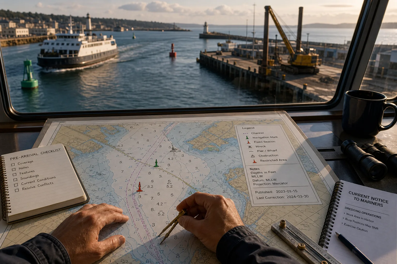
A cabin display shows a channel line beside a ferry route, a work pier, and a cluster of depth numbers. Reading a harbor chart helps you understand those mapped features, but it cannot tell you by itself whether conditions and instructions still match the picture.
Use the chart as one part of navigation, not as a live account of the harbor. This general article cannot establish a safe passage or replace vessel-specific navigation procedures, official chart products, current notices, or local guidance. For an actual passage, consult the applicable official sources and, where needed, a qualified navigation professional.
Symbols and legends
Harbor charts compress many features into compact symbols and labels. A buoy, fixed beacon, wreck, pier, restricted area, or underwater obstruction may be hard to distinguish when the display is small or several marks sit close together.
Start with the chart title and symbol key rather than guessing from a familiar-looking icon. Check the scale and display settings as well: symbols and labels can differ between chart views, and zooming can make source information easier to see without adding survey detail.
If a mark remains unclear, compare its label and position with current official information. If its meaning or a related restriction could affect the route, do not proceed on an assumption; seek clarification from the responsible harbor authority or a qualified navigation professional.
Depths and soundings
Numbers shown across water areas are soundings: charted depths referenced to a stated vertical datum. A sounding is not a promise of the water depth at the time of passage.
Read the chart’s depth units and datum notes alongside its contours. A contour connects places with the same charted depth and helps describe the bottom’s general shape, but it cannot show every local change between plotted points.
Tide and weather can affect water levels, while sediment movement and harbor work can alter the seabed. For a real passage, consult current official depth and tide information, account for the vessel and conditions under applicable procedures, and follow local navigation requirements.
Scale and currency
A harbor may appear on a broad-area chart and a more detailed harbor chart. The broad view shows how the port connects to surrounding waters; a larger-scale chart generally gives more space to local features. Neither view is live.
Check that the chart covers the intended area at an appropriate scale. A zoomed display can make labels clearer without adding detail to the underlying source, so do not treat enlargement as a substitute for suitable chart coverage.
Look for publication and correction information, then consult current official notices and harbor authority instructions. Dredging, construction, temporary works, and changed marks may require information beyond what a static chart shows. If sources appear to conflict on a route-affecting detail, pause and ask the responsible authority or a qualified navigation professional which information applies.
When should you seek clarification?
Why might charted depths differ from expectations?
Soundings refer to a stated datum and may not reflect current water levels or later changes to the bottom. Check current official tide and harbor information rather than treating a plotted number as present clearance.
Why can symbols differ between displays?
Scale, display settings, and symbol conventions can change how a feature appears. Use the chart legend and an appropriate official chart view instead of relying on an icon’s appearance alone.
Can a chart show temporary closures or works?
A chart may include established features and corrections, but temporary restrictions and active harbor work can change faster than chart publication. Check current official notices, harbor authority information, and required local broadcasts or instructions.
What if local guidance conflicts with the chart?
Do not assume an old chart or informal advice resolves the disagreement. If it concerns a channel, hazard, closure, or other route-affecting detail, pause and contact the responsible harbor authority or a qualified navigation professional before proceeding.
A careful reading order
Use this sequence to separate chart interpretation from checks on current conditions. Each decision is a prompt to verify information, not a substitute for vessel-specific navigation procedures.
- Confirm coverage: Check the chart title, area, scale, and official status. If it does not suitably cover the intended area, obtain appropriate official coverage before relying on it; otherwise, continue to the chart notes.
- Read the notes: Check the legend, depth units, datum, and publication or correction information. If any item is unclear, consult the chart key or an authoritative source before interpreting symbols or depths; otherwise, use those notes to guide the reading.
- Identify features: Check the channel, navigation aids, hazards, and restrictions. If a mark or label remains uncertain, verify it through current official local information; otherwise, compare the mapped features with current notices.
- Interpret soundings: Check the datum, contours, and any stated survey limitations. If they do not resolve a passage-critical depth question, seek current official depth guidance; otherwise, keep the charted depth distinct from present conditions.
- Check current conditions: Review applicable official notices, tide information, and harbor authority guidance. If they report a closure, changed mark, or work area, follow the applicable current instruction; otherwise, continue checking for unresolved route-affecting conflicts.
- Resolve conflicts: Compare the specific chart detail with the relevant current official source. If a conflict affecting the intended route remains, pause and ask the harbor authority or a qualified navigation professional before proceeding; otherwise, continue only under the vessel’s applicable navigation procedures.
Say you are reviewing an invented harbor chart for an arrival. The display shows a symbol beside the channel, a sounding marked 4.2 feet, and a current notice mentioning dredging; those are hypothetical starting inputs, not real harbor information. You check the legend and identify the symbol as a navigation mark, then read the chart notes to confirm that depths are in feet and referenced to the chart’s stated datum. Next, you compare the sounding and its location with the dredging notice and the harbor authority’s current instructions. If those instructions do not clarify whether the channel depth at that location has changed, your decision is to pause and seek authoritative clarification rather than use the 4.2-foot sounding as present clearance. The observable result is a specific unresolved question—the current depth at the marked location—to take to the responsible authority or a qualified navigation professional.
Limits of the chart
A harbor chart organizes mapped features; it does not settle every question about current conditions, vessel suitability, or local operating requirements. Keep each source’s role clear: use official, up-to-date charts for charted information, current official notices and local guidance for changes, and vessel-specific procedures for passage planning.
Reading a harbor chart is most useful when it helps you identify both what the chart shows and what remains uncertain. State the unresolved detail precisely—such as a symbol’s meaning, a reported work area, or a depth question—and take it to the responsible authority or a qualified navigation professional rather than filling the gap with a guess.
More harbor reading
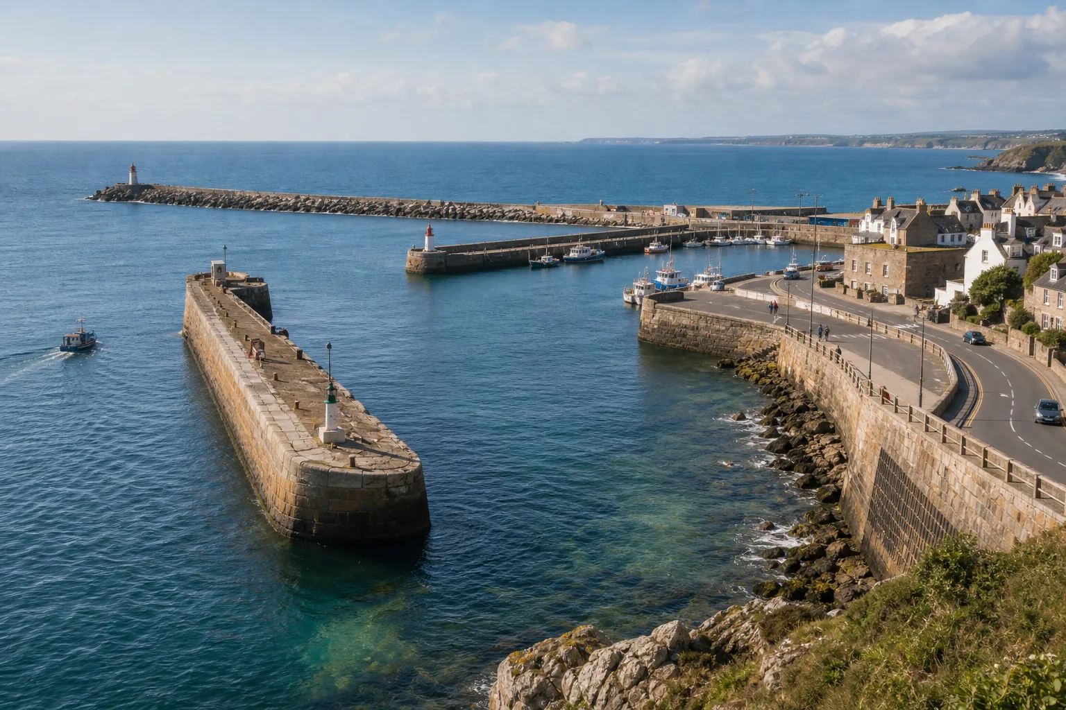
Breakwater, Mole, or Seawall: Three Edges Built for Different Jobs
Breakwater, mole, or seawall: learn how position, shoreline connections, and harbor surroundings help you describe each…

What Happens Between a Ship’s Arrival and Its Departure
A ship’s time in port follows a practical sequence, from berth assignment and cargo work to…